Hanalei Watershed Flood Mitigation Study
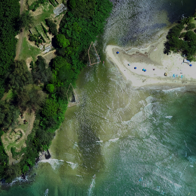
Hanalei River and Wai‘oli Stream are vital watercourses on the north shore of Kaua‘i, flowing from upper watersheds into a flat, wide floodplain that supports the abundant life and community of Hanalei. Across the floodplain is a mix of agricultural taro plots, wetland habitats for endangered waterbirds, pasture lands, parks, local shops, and residential areas. The lower reaches of both rivers are prone to flooding and can quickly inundate the surrounding areas, creating significant disruptions and risks to the community.
Despite the recognized hazards, no comprehensive analysis had been conducted to see how changes to the Hanalei River floodway might be increasing flood risks or affecting water flow through key areas like Kūhiō Highway. This led to a patchwork response, making it hard for the community to create lasting solutions for the protection of people, infrastructure, and wildlife.
In response, the Hanalei Watershed Flood Mitigation Study was launched to evaluate potential strategies for reducing flooding in the Hanalei and Wai‘oli Watersheds. The study focused on assessing whether these mitigation strategies could help reduce the frequency of Kūhiō Highway closures between Hanalei Bridge and Hanalei Town. A hydraulic model was used to simulate river conditions and evaluate the effectiveness of flood mitigation strategies in reducing flooding under current and future scenarios.
The study found that none of the potential strategies had a significant effect on reducing flooding in Hanalei or Wai‘oli. The primary reason is the strong tidal influence on the lower reaches of both rivers, which limits the effectiveness of traditional flood mitigation methods.
Climate change, rising sea levels, and increasingly variable rainfall are expected to exacerbate existing flood risks. As a result, the emphasis should shift toward climate adaptation rather than mitigation.
FINAL REPORT
Click to download
MITIGATION STRATEGIES
Flow conveyance improvements
intercept and temporarily store flood waters to reduce the rate and or volume of water impacting lower areas
-
Dredging
-
Vegetation removal
-
Ditch and ‘auwai maintenance
-
Berm and rock groin structure removal
Flood water storage solutions
slow, impound, or redirect flood waters from flowing freely through the river channel to the ocean
-
Construction of flood water detention basins
-
Enhancement of existing or historic wetlands and taro lo‘i
PRIORITIZING ACTION AND ADAPTATION
Although none of the evaluated strategies significantly reduce flooding, the study highlights actions that can address existing vulnerabilities and help prepare for the ongoing impacts of rising sea levels caused by climate change.
Raising Kūhiō Highway
Sea level rise is expected to continue affecting the region, with mid-range projections suggesting an increase of 1 foot by 2050 and 3 to 4 feet by 2100. This study used a 2-foot sea level rise estimate to model river water levels during regular and high flow events.
Future sea level rise will worsen flooding in Hanalei River and Wai‘oli Stream, leading to more frequent highway closures. Flood waters that currently stop short of the road will eventually overtop it, and the time it takes to flood Kūhiō Highway will decrease.
Raising Kūhiō Highway to a height that will remain above future flood water levels is recommended as an adaptation to impending sea level rise.
Hau Bush Removal
Although hau bush removal was not found to result in a significant reduction in flooding, it will:
-
Improve river navigation
-
Stabilize riverbanks
-
Reduce floodwater redirection
-
Enhance habitat for waterbirds
-
Open up scenic views
Channel Erosion
Riverbank erosion along the Hanalei River poses a risk to Kūhiō Highway and Ohiki Road. Road failures would have significant impacts.
-
Some vulnerable sections were identified during fieldwork.
-
Further evaluation should be conducted to identify all hazard areas.
-
Bank stabilization measures should be implemented to prevent erosion-related damage


Funding for this project came from two sources: Act 12, Session Laws of Hawai‘i 2018, which provided appropriations for funding disaster relief for Kaua‘i after significant flooding in April 2018; and a grant from the National Fish and Wildlife Foundation under the National Coastal Resilience Fund.
For more information on the Hanalei Watershed Flood Mitigation Study and its findings, please refer to the full report.
WANT TO HELP PROTECT HAWAIIAN WATERBIRDS?
Help monitor native Hawaiian waterbirds and contribute to local conservation efforts
The Pacific Birds Waterbird Survey Flyer explains how community members can record sightings of species using the free eBird app. Whether you're walking, paddling, or golfing, your observations help track bird populations and support restoration work in Hanalei's wetlands.
Learn How to Support Hawaiian Waterbirds
Pacific Birds has created a guide for local landowners on how to restore and maintain habitat for native waterbirds like the 'alae 'ula and ae'o


